

Quick answer
Tasman Peninsula weather follows a cool maritime pattern with year-round rainfall and strong winds common from May through September. Summer months (December to February) deliver the calmest seas and temperatures between 17°C and 22°C, making them ideal for boat tours around the island. Winter brings frequent gales, rough swells exceeding four meters, and temperatures dropping to 8°C to 12°C, often forcing tour cancellations.
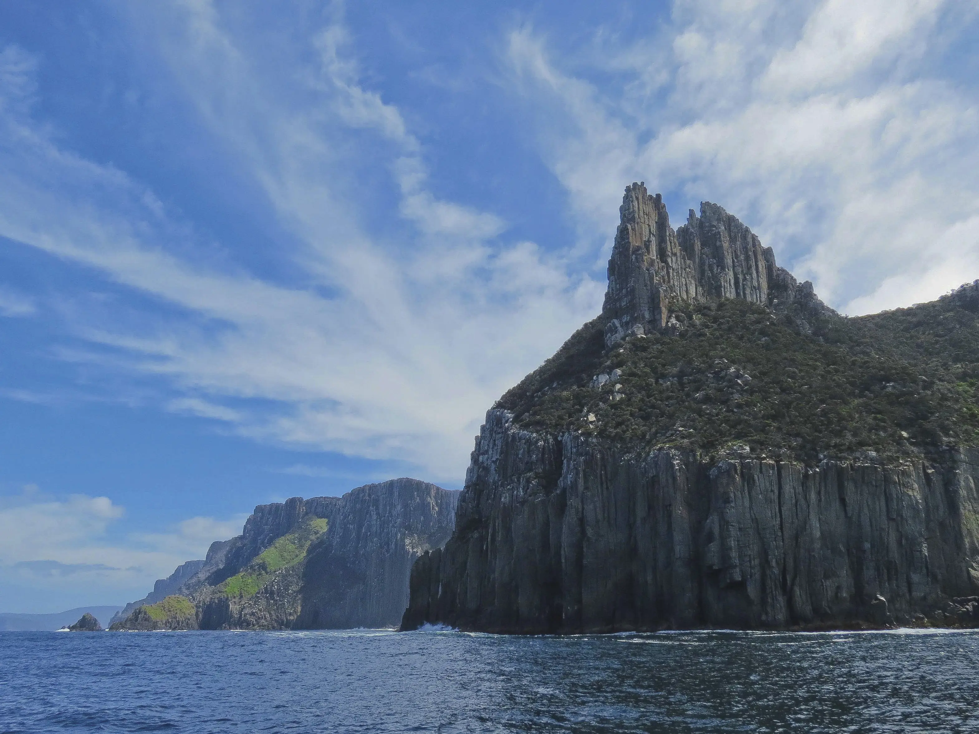
The Tasman Peninsula occupies one of Australia's most weather-exposed coastlines, a finger of dolerite cliffs thrust into the path of unimpeded Southern Ocean storm systems. Tasman Island, positioned three kilometers offshore, experiences conditions several degrees harsher than the mainland peninsula—wind speeds routinely register fifteen to twenty kilometers per hour higher on the island itself, and the channel between island and coast can transform from glassy calm to two-meter chop within an hour. Tasman Peninsula weather divides into two distinct regimes. Summer delivers the peninsula's most reliable window: December through February see average maximum temperatures near 20°C, rainfall dropping to roughly 45 millimeters per month, and northwesterly winds moderating to ten to fifteen knots on stable days. These months account for ninety percent of successful circumnavigations, when tour operators can reliably access the island's eastern coves and lighthouse base. Autumn extends the favorable season into March and April, though southwesterly swells begin building and afternoon sea breezes intensify as the Tasman Sea cools. Winter and early spring present formidable conditions. June through August bring persistent low-pressure systems tracking across Bass Strait, generating four-to-six-meter swells that pound the island's southern cliffs and render approaches dangerous. Rainfall peaks at 65 millimeters monthly, horizontal rain is common, and temperatures hover between 8°C and 13°C. Tour cancellation rates exceed sixty percent during these months. The shoulder month of May sees transitional weather—some operators extend their season into early May during high-pressure windows, but reliability drops sharply after mid-month. Maritime forecasts for the Tasman Peninsula region update three times daily through Australia's Bureau of Meteorology, with specific attention to wind strength in the Tasman Island area and swell period in the Southern Ocean approaches. Tour operators monitor overnight wind shifts closely, as westerly changes can produce shore dumps at landing sites that were calm at dawn. Sea fog occurs year-round but concentrates in late summer when warm air masses cross the cold Tasman current.
“Wind speeds on Tasman Island routinely register fifteen to twenty kilometers per hour higher than the mainland peninsula, and conditions can shift from calm to hazardous within an hour.”
Understanding Tasman Peninsula Weather and Optimal Viewing Times
The period from December to March offers the most stable maritime conditions for coastal visibility. During these summer months, the Tasman Peninsula experiences calmer seas and higher likelihood of clear horizons.
December–March
Moderate17°C–23°C; lower wind speeds
Warmer temperatures and reduced swell frequency improve sea conditions for coastal observation.
April–May
Low12°C–17°C; rising precipitation
Cooler air and increasing southerly winds often lead to more volatile sea states.
June–August
Low7°C–12°C; frequent storms
Winter weather brings rougher seas and consistent cloud cover, limiting visibility of the island cliffs.
September–November
Moderate10°C–16°C; variable winds
Spring brings transitional weather with frequent shifts in wind direction and sea swell.
Verdict: The optimal window for viewing the rugged coastline is between December and March when maritime conditions are at their most predictable.
Navigating to the Tasman Peninsula Weather Zone
Tasman Island is located off the southeastern tip of the Tasman Peninsula in Tasmania, Australia. As the island is restricted to public access, the only method to reach the area is via certified boat tours operating from the mainland.
A9 highway from Hobart to Port Arthur
Departure from Port Arthur via certified tour operators
Tasman Peninsula Weather and Official Operational Hours
Tasman Island is closed to public access; therefore, there are no operational hours for visitors.
| Monday | Closed | |
|---|---|---|
| Tuesday | Closed | |
| Wednesday | Closed | |
| Thursday | Closed | |
| Friday | Closed | |
| Saturday | Closed | |
| Sunday | Closed |
Tasman Peninsula Weather and Maritime Environment Facts
The Tasman Peninsula sits at the edge of the Southern Ocean, where extreme maritime conditions define the island's unique meteorological and geological landscape.
300-metre dolerite cliffs
The island is defined by vertical sea cliffs, some reaching heights of 300 metres, which are battered by constant oceanic swells.
High-energy wave exposure
The coastline experiences significant wave energy from the Southern Ocean, which has carved deep sea caves and arches into the dolerite rock.
Prevailing westerly winds
The region lies in the path of the Roaring Forties, resulting in consistent, strong westerly winds that influence both weather patterns and local vegetation.
Isolated maritime climate
Tasman Island functions as a remote outpost, experiencing high humidity and rapid shifts in barometric pressure due to its exposed location.
Southern Ocean storm surges
Large storm surges frequently impact the island, demonstrating the powerful influence of unhindered deep-sea swells on the peninsula's southern perimeter.
Dolerite geology formation
The unique, hexagonal column structures of the island's cliffs were formed by volcanic activity and subsequent cooling, which now stand exposed to harsh coastal weather.
Check availability
Frequently Asked Questions About Tasman Peninsula Weather
Everything you need to know about tasman peninsula weather